Tuesday, 1 February 2011

Images of the Brisbane floods 2011

High water everywhere. This is Part 2 of the Brisbane floods. Read Part 1 here:
brisbane-queensland-flood-disaster-2011.

Prologue (01 February 2011):
Queensland is once again bracing for another natural disaster.
In the next 24 hours or so, North Queensland, centered on Cairns, will be hit by what is predicted as possibly the worst tropical storm ever. Experts are saying that Cyclone Yasi is comparable to Hurricane Katrina that hit the US in 2005. This superstorm looms just after the floods last month, the worst natural disaster in Australia's history. Can it get worse?

But first-
With a measly 35,000 words this post has to be one of the longest blogs ever. This is a photoblog, and if a picture's worth a thousand words, and there's at least 35 photos here, you can do the maths :-).

Path of the flood. From Toowoomba to Brisbane is about 140km as the crow flies.

The orange balloons mark flooded areas.
The blue lines are the approximate centre threads of the rivers Lockyer, Stanley, Brisbane and Bremer (in Ipswich).


On the two days of the peak of the floods (13-14 January 2011), I voluntarily reported to the floodzones, albeit i was still officially on leave. At some stage in the future, I might be involved in delineating some of the extents of the floods. During the floods, the authorities have been pleading with people to stay off the streets and away from the flooded areas. But the term 'rubbernecker' exists for good reason. Some people just have the desire to have a look. Lest I be mistaken for a rubbernecker, and to look like an official, I took out my Maritime Security Identification Card (MSIC ID card issued for working in the Port of Brisbane).
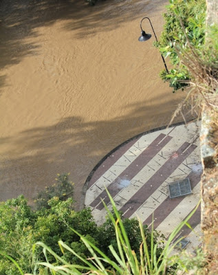
Many graphic, striking, and unforgettable images have been shown on TV and news outlets and will stay imprinted in many people's memories for a long time. The photos below are not of the devastation - we've seen enough of those - rather to show the extents of the floods - how high and far and wide(vertically and laterally).
Under the Captain Cook bridge (Southeast Freeway)

Snagged under the Goodwill bridge. I did a bit of work for that bridge as well as Kurilpa bridge upstream.

Cars on a standstill on the Captain Cook bridge, onlookers at the cliffs, and sailing debris.


'Jetty' in Bulimba.

Getting toes wet. They need a ferry to get to the ferry.

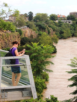
Showtime. It's a packed house on the Kangaroo Point cliffs.
Various media organisations have encamped there for days.

These boats are lucky they're well secured. Many others have floated past, to the sea.

High water on a sunny day. Very surreal.
Just on the river's edge in the CBD on the left (near the boats) is the Eagle street pier.
This precinct was among the first to go underwater.


There must be nothing compared to watching the river grow.


It's called 'Forceful Brisbane'. Quite apt.


Rubberneckers.

They're called Uzis in the Philippines. I hear there's an anti-usisero bill afoot there.
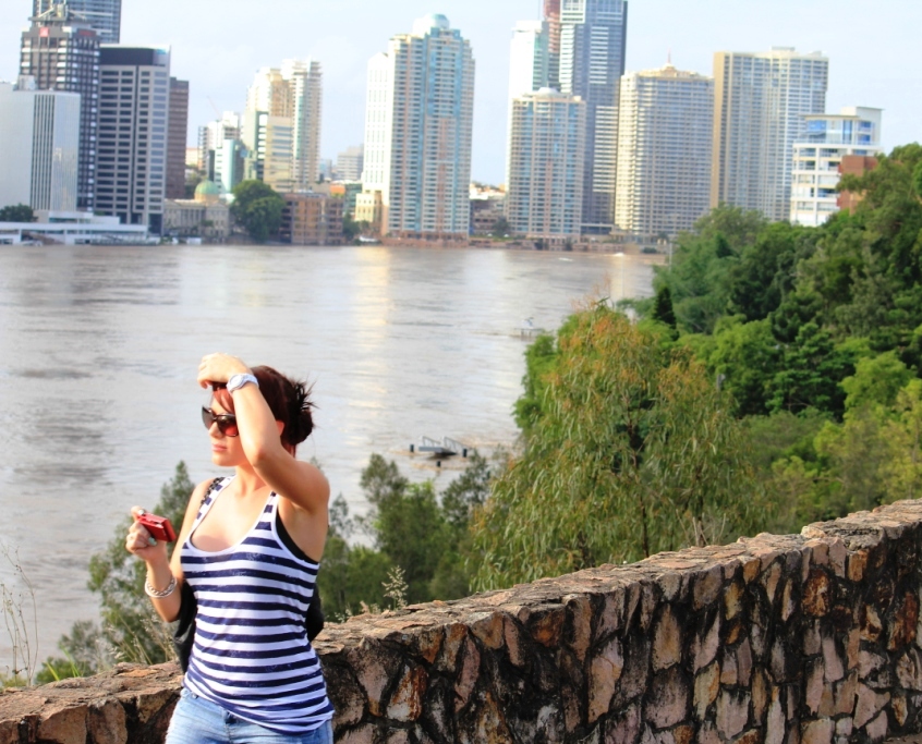
An onlooker. I like looking on too, sometimes - to the city highrise.

Brown mud stains on a high river bank in Indooroopilly show how high the floodwaters rose.
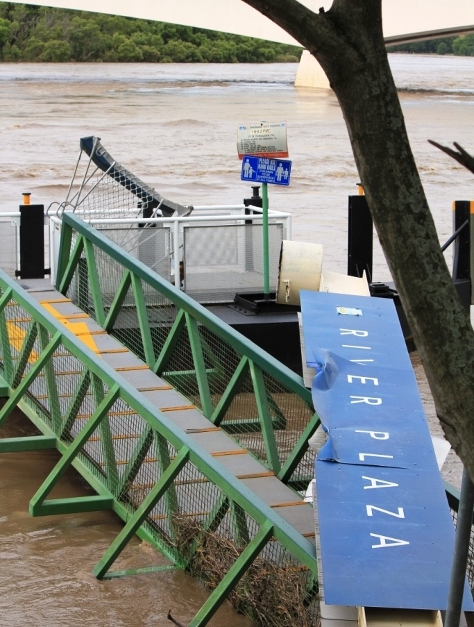
Another lamented ferry terminal.


Playgrounds are offlimits for now.


The days were fine during the height of the floods. It was so eerie.

Got that sign right.

Police have cordoned off all access to the parklands.

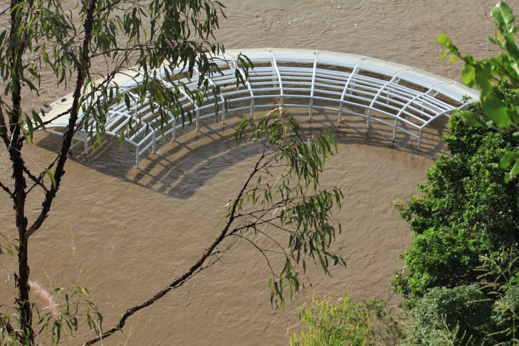


It was quiet there for awhile. Until Julia came to have a look-see. Ms Gillard, the PM was there to do media interviews. And she brought along her security detail. A media scrum soon ensued. I could not even get close for a Prime Ministerial hug and kiss - as you do.

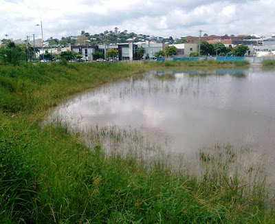
This is not a lake. It's a flooded site in Newstead.

Gauging the depth of the floodwaters.

Click below to watch a slideshow of the photos (with music).

Friday, 28 January 2011

ode to brisbane

I was out doing some fieldwork today. On the way back to the office I switched on the radio in time to hear the premiere of a fun poem on ABC Brisbane (612 KHz on the AM dial). You can listen online through your computer's media player by clicking Win (Windows Media Player) or Real (Real Player) in the righthand panel under Internet Radio 612 ABC Brisbane.
The program is called Afternoons with Richard Fidler, and the host had a local poet Daniel Viles on the show. Here's Daniel's ode to brisbane post Flood '11.
The poem's a lot more fun recited, so i suggest read the poem and have a listen to the audio after.

link to audio
(The bold place names in the poem are Brisbane suburbs).

We moved here for the weather
posted 28 January 2011 by Rebecca Levingston
Daniel Viles is the poet laureate of 612 ABC Brisbane.
Today he poured his heart into a poem about his home town.
Brisbane... we moved here for the weather.

We Moved Here for the Weather
Oh sing a song of Brisbane! Top of 32 and fine.
Two million earthen vassals tightly squished and crammed together.
The number of us born here is approximately nine
and the rest of us just moved here for the weather.
"Pack your bags, we’re heading northward,” said the middle third of Melbourne.
“Thus us choice,” said much of Auckland as they emptied the City of Sails.
There were several trucks from Adelaide, maybe one or two from Perth
and there’s no-one left in country New South Wales.

And those born here made them welcome, taught them basic navigation,
though they kept on saying TOO-wong and they couldn’t spell Coorparoo.
And it’s grating when your lover says, “meet me in ten at Ow-chen-fluvver” (Auchenflower)
but you meet them ‘cause they’ve got more cash than you.

Like the quarter million merchant bankers who ran from Collins Street,
some who built their Windsor castle, some who built their Chelmer chateau,
some who built their Moggill manor, some who looked down past their feet
as they built their fort atop Monto Gravatto.

Like the hundred thousand property investors from Vaucluse,
all of whom self-relocated ‘fore the economic slump.
When asked, “Pray tell where you’re born?” They each proudly answer, “Er, Hawthorne,
For compared with here, Vaucluse is just a dump.”

Then there are those from overseas, like six thousand Sudanese
who fled the terrifying tank, the belligerent bazooka.
You can build a whole new life here if you just hold our your hand
in the land of opportunity: Moorooka.

Greeks and Italians moved to West End and became each other’s best friend
sharing baklava di Bari and spaghetti spartagiana.
While the Tongans and the Maori now live handsome in Bellbowrie.
You’re from Vietnam? Hey, welcome! Here’s Inala.

Here’s to those who built on Milton, those who grow that Rocklea broccoli.
There’s no more well-heeled than in Fairfield through the whole Antipodes.
Have you noticed how uncannily El Dorado looks like Annerley
and how no language makes you swoon like Rosaliese?

No metropolis created is by praise so ‘unindated’.
It’s a Gamma plus world city setting forth to snap the tether
that’s been binding those few people who were actually born in Brisbane
and the rest who simply moved here for the weather.

(c) Daniel Viles 2011


Tuesday, 25 January 2011

Articles on Guina-ang

Just piggybacking the articles with some photos.

A photo of Guina-ang from decades ago
  
A more recent photo - still from the last century.
Centuries ago the barrio (village) of Guina-ang used to be part of Chonglian. At the height of inter-tribal conflicts, the collective councils of elders of the different wards of Mainit allowed the hamlet to be settled and to serve as lookout post against hostile intents from enemies from the south of the citadel of Mainit. Those days are long gone obviously, and Guina-ang ended up being settled by many families with roots from Mainit, as well as from nearby Maligcong and Dalican.


Photo of Guina-ang from deep in the mountains of Mainit to the north. In the background is Mt Kalawitan in Sabangan municipality.


Now to the articles:
A couple of oldish documents (on Guina-ang) here by Lawrence Reid. The first is on music and dancing. The other is a typical calendar of barrio life in Guina-ang in the 1960s.

First Article. dancing and music notes from guina-ang

Dr Reid writes:

Notes for this paper have been gathered during an eighteen month's residence in Guinaang, mainly from observation, but also from an informant, Benedict Sibfay, a middle aged man who has spent most of his adult years in the village. The data cannot be guaranteed as representative of the dancing or music of other Bontoc areas. There has been little observation of practices outside of Guinaang, but it is assumed that within the Central Bontoc area, comprising the Barrios of Mainit, Dalican, Malegcong, Tococan, Bontoc, Bontoc itself, and extending to Sadanga in the North and Bayyo in the West, the overall pattern would be the same, although details may vary from place to place. All terms used are local Guinaang terms.

More photos from deep in the mountains of Chonglian.

Guina-ang is at centre of picture. Dalican on the right.


Second article. THE 1960 CEREMONIALCALENDAR IN GUINAANG


These are available on the net. Click on the links.


Market stalls in present-day Guina-ang. They sell mostly bakery products and fresh local vegetables. There are no 'market days' in Dr Reid's calendar from 50 years ago.
 

Monday, 17 January 2011

Brisbane (Queensland) flood disaster 2011

Hydrology 101. Study of floods. A layman's take on the Brisbane floods of 2011.

The Catchment at a Glance.
The Brisbane River Catchment area is about 13,500 sq km. This catchment includes the Upper Brisbane, Stanley, Lockyer and Bremer Rivers. It includes 850kms of river and lake banks as well as 50 major creeks.

Over 85% of the catchment has been cleared and developed into various land uses, including rural (grazing, cropping and forested lands) and urban centres (at the lower catchment). This holds the largest population of any catchment in Queensland.


Photo shows an illustration of a typical catchment or drainage basin.
The Brisbane river catchment is equivalent to an area about 135km by 100km or about 70% of the Cordillera, and just slightly smaller than the land area of East Timor. This catchment could cover an area similar to part of the northern Philippines covered in the photo below. (Obviously this area of the Cordillera is NOT just in one, but several catchments).


This is merely illustrative as the Brisbane river catchment is more rough (apparition-shaped) and irregular, than rectangular (below). The path of the inland tsunami went from west to east (Toowoomba to Brisbane) for about 150km.


The critical centres affected by the floods are highlighted further in the photos below.

Before the deluge
According to experts, this summer (wet season down under) marks one of the strongest (if not THE strongest) La Niña events since records began in the late 19th century . The Bureau of Meteorology, as early as October, was warning of substantially increased rain across eastern Australia.
In the previous October and November, the Brisbane river catchments received more than their fair share of spring and summer rains. Brisbane experienced its wettest December in 150 years.
After the last great flood disaster in 1974, Lake Wivenhoe was dammed primarily for flood mitigation purposes and to protect Brisbane from a similar Q100 (one in 100 year event). However the dam was nearly twice its capacity (193%) at the height of the rains, and cannot hold anymore water had the rains kept falling. The other main dam in the catchment, somerset dam was at 160%.

Northern part of Brisbane River catchment

Southern part of Brisbane River catchment

What transpired.
• Three weeks of rains had saturated the city of Toowoomba before it was hit by a line of intense thunderstorms and 36 hours (and more than 160mm) of torrential rains causing sudden or flash flooding on 10 January 2011.

• The massive volume of water generated by the super rainstorm, later described as an 'instant inland tsunami', surged as a devastating wall of water and tore through the city centre of Toowoomba which sits on a plateau in the watershed of the Great Dividing Range, some 700 metres above sea level.

• In the evening, within hours it had claimed many lives as it surged downstream on Lockyer creek rolling past and wiping out chunks of the townships of Murphys Creek, Grantham, Withcott and others in the mostly flat Lockyer valley.

• During the storms, floodwaters from the surrounding hilly catchments on the north and south, including the  major tributaries of the lockyer river (Laidley Creek, Tenthill Creek, Murphys Creek and Ma Ma Creek) added to the ever swelling watery terror.

• This inland tsunami reached heights of 8m and perhaps more than 1000 metres (1km) in width (a serviceman interviewed on ABC tv said between 1-2 kms) as it gathered pace and volume on its way along the lockyer valley towards Ipswich and Brisbane, more than a 100kms and two days away in the east.

• On another tributary, the Bremer River at Ipswich - some 30 kilometres west of Brisbane - reached a height of 19.4 metres on 12 January, inundating the CBD and flooding at least 3,000 houses. One third of the city was flooded and thousands of people were evacuated.

• Already on 11 January 2011 in the afternoon, the Brisbane River broke its banks leading to evacuations in the Brisbane CBD. On 12 January the flood peaked during the afternoon high tide at 4.5m, about 1m less than the previous peak in 1974. Thousands of homes and businesses have already been evacuated.

• The tsunami from Toowoomba hit Brisbane on Thursday. Along the way the raging torrent from lockyer river joined forces with rainwaters from all the sub-catchments. This watery terror, increasing in size all the time, went through and literally obliterated the towns and fields in its way. It merged with the Brisbane river and the swollen waters of the bremer river, just downstream of Wivenhoe dam and again magnified in size as it roared inexorably towards Brisbane and beyond to Moreton bay. On 13 January the floodwaters peaked at 4.46m in Brisbane but still inundated 20,000 houses in 80 suburbs. The rest is history.

The latest figures are 20 dead and 10 missing.And in breaking news, Queensland Premier Anna Bligh has announced a commission of inquiry into the state's devastating floods.The inquiry will be conducted over 12 months with an interin report to be provided in August, in time for the next wet season.
Watch this space.

Summary:

1. La Niña and low pressure systems in spring, resulted in unusually high levels of precipitation or increased rainfall throughout October to December. These rains have saturated the catchments and the ground can not absorb or hold any more water.

2. The dams built to reduce flood severity (flood mitigation purposes) are nearly overflowing. eg Wivenhoe dam at 193% capacity, Somerset dam 160% capacity.

3. 85% of the Brisbane river catchment has been cleared or developed. Trees and vegetation create space in the soil for rainwater to move in and get absorbed. Development, deforestation or simple land clearing, cause compaction filling up the soil space used by air and water. The result is increased and accelerated runoff and drastic topsoil erosion.

Postscript.
Had it kept raining through to the height of the floods, things would be way way worse. Rains abated around midday on 11 January, and cloudy but mainly fine weather followed from that day.Seventy five percent of Queensland is a disaster zone. (That's more than 4x the size of the Philippines, more than 5x the size of Great Britain or nearly twice the size of the 'big' state of Texas).

Around the state, many other towns (Ingham, Babinda, Gordonvale, Rockhampton, Emerald, Bundaberg, Dalby, Toowoomba, and Ipswich, Condamine, Chinchilla, Theodore, Moura, Rockhampton, Gympie, Goondiwindi) are experiencing their worst floods.

Numerous Roads and highways remain closed and impassable, and the only way to travel between centres is by helicopter. Many regional airports remain closed too. Flood warnings are current for many rivers (Herbert, Fitzroy, Burnett, Condamine/balonne, Mcintyre, Mary).

The great flood of brisbane in 2011 is over. The waters are receding. Let us keep Queensland and Queenslanders in our thoughts as they get back on their feet.
Note too that all around the world, disasters are also happening and continue to happen. Floods are also causing death and destruction in the Philippines, Brazil and Sri Lanka. There are bombings in Pakistan and Afghanistan. Elsewhere in Australia, there are record floods in northern NSW, Tasmania, South Australia and Victoria. All these even as Haiti remembers last year's earthquake. 
Let's put things in perspective.

And if we can live with less of the luxuries, that might be a start. Perhaps mother nature will be less severe next time.

Read Part 2 of this blog here.