Last year on a
weekend I went to Kaban (Springbrook) to study a bit of the rock formations and
landforms from an ancient volcano. Kaban is in Springbrook National Park on
the McPherson Range in
the South East of Queensland.
It forms part
of the UNESCO World Heritage-listed Gondwana Rainforests. Springbrook is for those who love nature. It has ancient
forests, lookouts, walking trails, beautiful birds, various wildlife, rare
plants, and much much more, like numerous waterfalls. Many of the waterfalls,
lookouts and walking trails are easy to access for everyone to enjoy the
rainforests on Springbrook Mountain. Geological processes formed the canyons, valleys and cliffs of hard
lava where channels, brooks and streams have been carved out from. I was keen
to check out the paler Rhyolite rock and the darker but softer coloured Basalt.
These have eroded over millions of years due to the elements. Apparently too, the
climate had changed and the canyon was getting deeper at a rate of about 3mm in
a lifetime. I wanted to see - with my own eyes - this 3mm deepening of the
canyon - in my lifetime. It sounded more exciting than mowing the lawn or watching
the grass grow.


Nature, somehow,
was not with me on this trip. The clouds were gathering from Saturday evening on,
and rain commenced on Sunday. It rained steadily all day and very heavily all night.
Springbrook was well and truly saturated in 125mm of rain in the deluge. I was
undeterred and took to setting up camp for the night, up where it’s raining on
the rock plateau, on a grassy patch overlooking the Gold Coast below – and watching
the grass grow. It was 10 months ago, on a cold dark night. The deluge caused high
water everywhere on the high mountain.

The skies cleared
on Sunday and I set forth to examine the rock slabs, the sheer cliffs and
escarpments of Springbrook National Park. Nature set her traps overnight of
course. The tempest felled trees and dropped branches in my path. The might of
high floodwaters moved boulders and fallen tree trunks, and diverted the
streams on to a new course. The raging waters created deep ruts, and exposed sharp
rocks and gnarly roots along their way and mine.


They even have
translations of many of these names for the benefit of those recent arrivals –
translations to their strange unpronounceable language: big waterfall, blackfellow, circuit, dancing waters, deep place, little
waterfall, purlingbrook, natural bridge,
silver rain, out of the rushes, over the trees, rainbow, rushing, three falls,
twin falls.

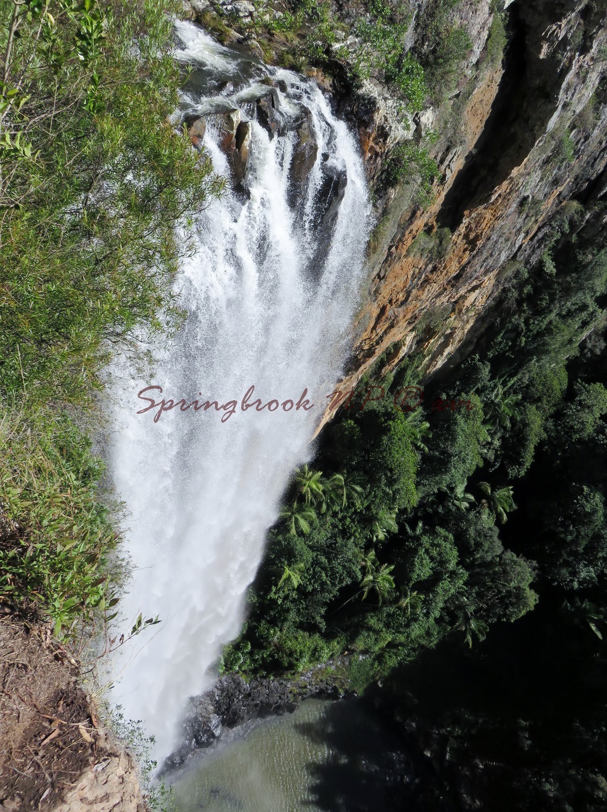
The Twin Falls is on the four-kilometre rainforest circuit from the
Tallanbana picnic area or canyon lookout going in the anti-clockwise direction.
The Twin Falls are two rushing waterfalls that greet you as you descend down the
narrow winding track where the
falls then cascade down into rock pools.


Then there are the others: Rainbow falls, Kadjagooma, Goomoolahra, Ngarri-dhum. Many of these
places drop from a height of some 200m - from the plateau to the base of the
cliffs.


So anyway all the
channels and dips on the rocks that I wanted to examine now had this liquid matter flowing over them. Disappointment is such a mild word to describe what I was feeling
at not being able to check out the rocks. Getting frustrated, I ran around to
all the high cliffs and deep gorges where the rocks have been gouged out. But
the deluge was that huge – every channel was flowing at maximum height.


Rainbow Falls
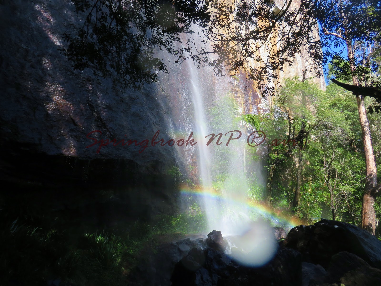


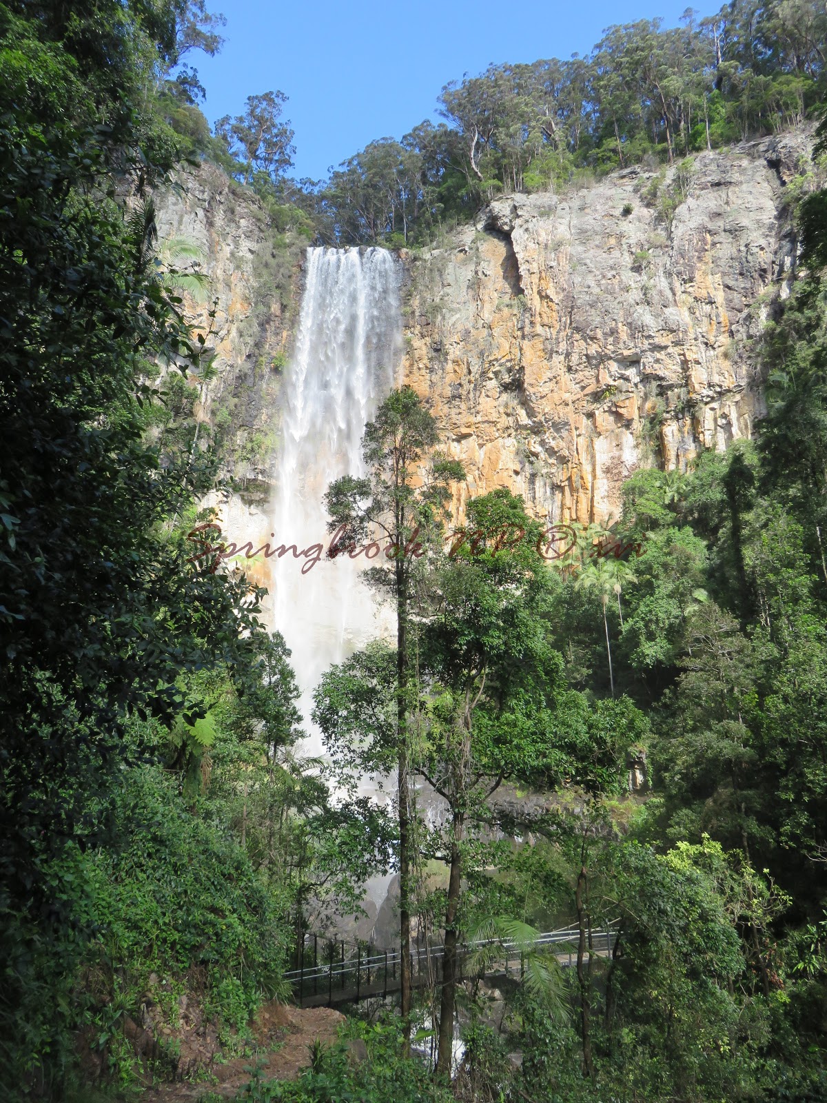
Meanwhile, back at the lookout-


At the Lookout, I tried the 106m
high cliff face of Purlingbrook, it too was covered under a great wall of water. The Purling Brook Falls is a horsetail waterfall situated within the central section of the national park. After heavy rains the waterfalls
become an incomparable spectacle.


But the base of the falls was no different. There was so much water.


And so many rainbows.


Watered and rainbowed I was defeated.
So with head bowed I retreated.

And retraced my steps.


Circled the circuit of rainbows.


Then looped back to the top lookout.


and looked down.


When I looked back up, I thought of one
last place to salvage something on this trip.


The message was not lost in translation.

It was lost to the world.
