The first quarter of this year has been and gone.
Just like that. And winter's here. Yes indeed, just like that.
I have not been sticking to timetables and
schedules and whatnot. I’ve never been a stickler to the very structured, the
well-organised up-to-the-minute kind of plan. Sometimes we should bend with the
wind or go with the flow. That said, I have planned for my workstyle not to be
all about gasfields or pipelines or the bush.
Likewise I prefer not to be working in an office while I still have legs
able to carry me around. It’s all about balance. The Chinese have this worked out long ago. The concept of "yin and yang" to achieve harmony. Life’s like that.
In this life we need freedom, not a bill of rights.
And flexibility allows for a bit of freedom. Freedom’s just another word for
when things don’t go to plan. Processes that are too rigid or regimented do not
allow for choice. I cannot have that. And so it is with blogging, sometimes
I’ve got nothing to say. So I choose to ‘show and tell’ without the tell J.
Anyway while I’m not traipsing out bush in the coalface
of development in southern Queensland, I’m involved somewhere else doing what I
can to put food on the table.
In early 2012 through to March, I spent a few weeks
working in the areas between Kogan and Wandoan.
In Miles, I avoided the hangman,
and made a wish upon a star of a wishing-well.
It was the height of summer,
and I watched the locals play their silly game -
under lights in the bright afternoon sun.
Must be the global dimming.
It was more exciting watching the grass grow, at the feet of camels in the wild.
During the off stints, work brought me to other
places in and around Brisbane in the southeast of Queensland.
Caboolture in January had some very wet grounds
from above average rainfall. This did not prevent us from working the bushlands
around the aerodrome. I'd rather have gone gliding, but watching the paint dry on the light planes is more thrilling :-).
Crawling through the thick eucalypts, water was up to our necks in the swamps and tall grasses. We were told of the presence of snakes in
them lakes. I did not meet even one.
Not far off Caboolture and Moreton bay is Griffin on the northern banks of the North Pine
river. We did some more walking
around the open forest stands there. Then southwards past Bald Hills and Carseldine, I
once tracked Chinaman creek road in the Little
cabbage tree district of Aspley.
Come February I took flight again - off to the Western Downs and Columboola, and beyond to Miles, then Bundi and Clifford northeast of Roma.
The colours of the landscape under the flight path kept changing hue.
From grey to green, from gold to blue.
I took to the roads, the trees and bushes.
I hid behind the bottle... tree.
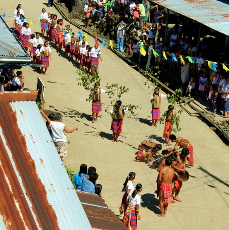
Off Tribes Road, I heard the tribes a-moaning.
Mines are careful not to disturb indigenous Aboriginal artefacts,
or the spirits won't be happy.
In March the bright city lights enticed
this wanderer from puklis, back to the metropolis. Southbank in South Brisbane is a bustling commercial
hub, a beehive of metropolitan activity.
There are cafes, parks, apartments,
offices, museums, art galleries, transport centres, etc and just recently a radio
station (ABC) has relocated there.
I looked in on some shops and parkland
features.
My shoes are made for striding,
but her boots are made for walking.
In Southbank, you can safely go under a ship's hull or propeller.
You can even get shipwrecked. The island's just at hand.
Next to the heritage-protected South Brisbane railway station is a
newly constructed extension of the Brisbane convention and exhibition centre. A
mix of old and new. Australia’s like that.
From Southbank I also ventured out to the north
banks of the Brisbane river in Hamilton. Hamilton is home to wharves and expensive apartments. It is also the
site of an international cruise terminal.
I was going on a cruise... no not on that thing.
My mate's got a dinghy hidden in the mangroves.
Up in the sky...It's a bird...It's a plane...It's super-
It's a boat?
Eagle Farm and Pinkenba are industry centres
outside the adjacent Brisbane airport.
But lurking in the mangroves, sometimes the locals pop out for a chat.
Northshore 'beach' is at least 12km from the Brisbane river mouth on Moreton Bay.
And then back on the north of Brisbane in Deception
bay and Rothwell.
Deception bay is a deceptive shallow bay mistaken for a river
by the explorer John Oxley, hence the name.
In from the bay is a cockatoo shopping centre.
Or maybe they're waiting for the bus.
Cockatoos perform in twos,
but in the afternoon they come in fives, at five.
Rothwell is home to the Redcliffe
airport. Fitzgibbon a greenfield
site suburb in northern Brisbane, is undergoing a facelift to upgrade its service infrastructure,
community and street and transport facilities.
The cool breezes of April blew me south to Salisbury
and then to the landscaped townhouse community of Norfolk village in Ormeau.
Salisbury, home to Toohey mountain
and forest, has lots of walking tracks.
Sounds like a place to be. The mountains are calling me home...
First I have to get my job done. Do the tests, and pass the tests.
And then I can be free to fly - like an eagle.
.jpg)
.jpg)
.jpg)
.jpg)


.jpg)
.jpg)
.jpg)
.jpg)
.jpg)
.jpg)
.jpg)
.jpg)
.jpg)
.jpg)
.jpg)
.jpg)
.jpg)
.jpg)
.jpg)
.jpg)
.jpg)
.jpg)
.jpg)
+(1280x1114).jpg)
+(1280x990).jpg)
+(1280x1024).jpg)
+(1280x1244).jpg)
.jpg)
.jpg)
.jpg)
.jpg)
.jpg)
.jpg)
.jpg)
.jpg)
.jpg)
.jpg)
.jpg)
.jpg)
.jpg)
.jpg)
.jpg)
.jpg)
.jpg)
.jpg)
.jpg)
.jpg)
.jpg)
.jpg)
.jpg)
+(1280x1075).jpg)
+(1280x1051).jpg)
.JPG)
.JPG)