The wonders of Mount Pulag National Park February 2017
Travelling the ‘Mountain Trail’ in the last half-century, I would have gone past Mount Pulag a hundred times or more. And on 99 times out of that 100 trips, the mountain would be shrouded in cloud or mist or being drenched by rain.

Mount Pulag is the third highest mountain in the Philippines, next
to Mt Apo and Mt Dulang-dulang in Mindanao. Due to its accessibility and fairly
easy trails, it has become a popular destination for mountaineers, hikers and
tourists. This has put me off climbing the mountain for many a-year.
 But a couple of
times early this year, Mount Pulag was actually cloud-free and its bald peak quite
clear from the Halsema Highway in Atok 15 kilometers away. I thought this was a
good time as any (off-peak for Mt Pulag) to hike up its summit. Pulag (from
pul-ag meaning bald) at 2926m elevation, is the highest peak of
the Cordillera mountain range in Luzon.
But a couple of
times early this year, Mount Pulag was actually cloud-free and its bald peak quite
clear from the Halsema Highway in Atok 15 kilometers away. I thought this was a
good time as any (off-peak for Mt Pulag) to hike up its summit. Pulag (from
pul-ag meaning bald) at 2926m elevation, is the highest peak of
the Cordillera mountain range in Luzon.

Early one morning on a sunny day in February, after a two-hour
ride from Baguio, I found myself in Ambangeg in Bokod (gateway to Pulag). It
was mid-morning by the time I had done an orientation at the DENR office. All I
needed to do, prior to ascending the peak of Pulag, was to get myself to
Babadak ranger station and register for entry to Mount Pulag National Park.
Babalak in Kabayan, is up on the high slopes of Pulag, 10km from Ambangeg, and
higher in elevation by more than 1000m.
 There was the option to travel by motorbike (as a pillion
passenger), between Ambangeg and Babadak which is about a 35-to-40-minute ride.
I looked at my kit. Aside from the clothes I had on, there was only a small
overnight bag. And I had plenty of time to while away, so I chose to hike.
There was the option to travel by motorbike (as a pillion
passenger), between Ambangeg and Babadak which is about a 35-to-40-minute ride.
I looked at my kit. Aside from the clothes I had on, there was only a small
overnight bag. And I had plenty of time to while away, so I chose to hike.


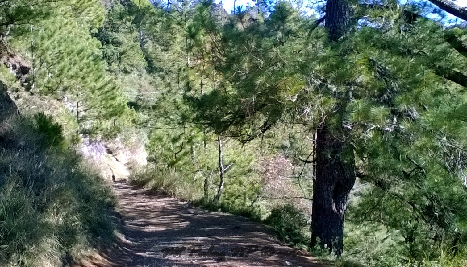
A gap in the pine trees lining the winding road, opens out to
the Atok range and Mt Timbak. And Timbak and the steep road going down to Kabayan in the deep
valley below.


In the east is the cloud covered Ambaguio-Kayapa range between
Pulag and Ugo.
'Ahh give me a break,' I muttered. 'I want to see Purgatory.'
'Ahh give me a break,' I muttered. 'I want to see Purgatory.'

a welcome break for a hiker’s broken plodding.

Looking up the hill towards Babadak.

Young Babalak boys at play.
Vegetable farms are a feature of the mountainsides.

I plodded on past farms and terraced fields. Oftentimes I just had
to stop simply to gaze at the magnificent views all around. No sir, I wasn’t
resting.

I looked back down to Ambangeg and Ambuklao, and beyond to
Baguio in the cloudy far horizon.

The mountains changed their cloudy garb every
few minutes.
It's more captivating than a ms universe beauty contest.
It's more captivating than a ms universe beauty contest.

After almost 2.5 hours of hiking I finally arrived in Babadak, elevation 2,450m.

From the heights of Babalak, Atok and Mt Timbak are much closer than from the Ambangeg trail.

I registered at the ranger’s office.


Before nightfall I ambled around the town and took some more
photos looking towards Sayangan and Ambuklao, and in all other directions.


In the gloom I also aimed my camera towards Baguio.
The rooftops of Bekkel are still shiny in the foreground.
The rooftops of Bekkel are still shiny in the foreground.

As clouds rolled in with the
dusk on the south, I witnessed the birth of a rainbow right over town.

It was getting dark and soon enough, as it must, night fell.

The major trails that lead up to the summit, commence from or near the
mountain towns of Bokod, Kabayan, Buguias, Tinoc and Kayapa. The towns, villages
and sitios situated in the surrounding foothills are settled mainly by the
Ibaloi, Kalanguya, Kankanai and Ifugao ethnic groups. Mount Pulag - ‘playground
of the gods’- is sacred to these indigenous peoples.
The main trail to Pulag from Babadak/Babalak (Ibaloi/Kalanguya),
is a fairly easy ascent for those in good health and fitness. The peak is
around 7.5km distant (with 500m of climbing) on the Grassland Trail from the Ranger’s
Station. Hiking guides allow up to five hours for the climb to the summit
although experienced and stronger hikers take as little as two hours or less. Hiking
groups usually start from 1:00am to catch the sunrise at the summit.
On this trip, I was hoping for clear weather and to witness
sunrise on Mount Pulag. The next morning proved very favourable and my hopes were answered by the anito of the Livo-o.

I gazed in awe at the horizon
at the sight of the sun a-risin’.


The views in the first hour or so after sunrise are simply
awesome.

Earlier in the day, I woke to the first crow of roosters two
hours before the break of dawn.
After nearly two hours of steady hiking, Rita (my guide) and I arrived at the summit.
We got there with plenty of time before the Pulag meridian moved further around to greet the sun.
I ‘chilled’ for a bit, then I got to behold sunrise from Mount Pulag.
After nearly two hours of steady hiking, Rita (my guide) and I arrived at the summit.
We got there with plenty of time before the Pulag meridian moved further around to greet the sun.
I ‘chilled’ for a bit, then I got to behold sunrise from Mount Pulag.

I can post a thousand photos and write a thousand words,
but they won’t do justice to the magnificence of what the eyes can see from the
top of Mount Pulag.
What glorious scenes mine eyes behold! What wonders burst upon my view!

I guess you just had to be there.

The descent back, with lots of sight-seeing and spots for
picture-taking, takes between two-to-four hours of easy strolling.

Heavy foot traffic has caused scarring on the beautiful but
fragile grassy slopes of Pulag.
But it’s still best to keep to the formed trails.

A
way to help protect the grassland and forest vegetation and to prevent erosion
is to lobby government for better trails and maintenance. There are
now so many examples of mountain trails from all over the world to learn from. Paved
paths, stepping stones, raised mesh walkways, sediment barriers,
rainwater drainage, streams/waterways & wet
soil crossings solutions; any of these and more should be considered where
appropriate. After all, where do all the fees and funding go? I pondered that
myself. I was caught in the moment, thinking: 'this is rock and roll.'
Once upon a mid-hike early/ while I plodded, weak
and weary
Over many a damp and oldshoes sodden on forgotten
stone
my toe rock-stubbed, nearly tripping, suddenly got a-rolling.

'Eyes on the trail’ said Rita. 'A
wandering eye can cause a fall,
and a mossy stone can make you roll'.
I looked at my muddy and heavy worn-out
boots. Lucky they’re steel capped.
And although I meant to say ‘ouch’, I
blurted: ‘Yes ma’am, please wait up’.

'Rather, please wait down there,' I pleaded. 'I'm rollin'.
'And I'm hungry and my lunch is waitin,' said Rita. 'You keep to the trail.'
'And I'm hungry and my lunch is waitin,' said Rita. 'You keep to the trail.'


The sights were stunning and more eye-catching than any trail or highway that a rolling stone can get lost on.


So I’ll leave you with the pictures.
They paint their thousand words, and then weave
the words into their stories,
in a far better way than I or anyone can ever write.
in a far better way than I or anyone can ever write.

But you will never never know
if you never never go...


Now that young lady, if I can only catch up to her… I did ask at
the ranger station for a strong guide, but I wasn’t expecting a champion trail
runner. Rita runs trail races for fun, and she routinely gets on the podium.

But now we’re out of time for more stories… And I’ve ran out of breath. ‘Hey, wait for me!'


No comments:
Post a Comment
please leave a comment.