Another train ride in California.
San Francisco and Los Angeles are two of the more popular travel destinations in the USA and two of the biggest cities in California. The route between the two cities is much-travelled and there are several transportation options: bolakbol (amble), trail, pedal, paddle, aerial or automobile. I thought to toss a coin - heads ocean liner or tails air liner. Well I ain't got a nickel and I ain't got a lousy dime, not even for a coin toss. So I chose rail.
An 11-hour train ride on the Coast Starlight is a great option for budget travellers. It is cheaper than a pair of trail shoes, trailbike, bus fare, airfare, or filling up the gas tank. I’m told this train trip has great coastal views, but at journey’s end I will have seen more mountains than water and more mountain ranges than the coastline of the Pacific. Coast Starlight starts in Seattle and goes all the way to Los Angeles. Part of the route passes along the California coast including Emeryville in the Bay Area where I embarked.
I arrived in the ‘Bay Area' region around San Francisco Bay, the day before. Last evening I commuted downtown across the bay, over the Oakland-SF Bay bridge on the Amtrak thruway bus, to the Embarcadero to soak up a bit of the Financial District, the waterfront and night lights of San Francisco.
Pier 39 at the Fisherman’s Wharf district. The Pier has two levels of dining, entertainment, shopping, attractions and views. Then there's the restaurants, a video arcade, street performances, Marine Mammal Center, bay aquarium, virtual 3D rides, and the docks on the marina.
Pier 39 is on the northern end of the eastern waterfront of the Port of San Francisco. From the pier, there are views to the Golden Gate Bridge on the West, and on the north to Angel Island and Alcatraz. Across the bay to the east is the faint outline of Berkeley, and the SF-Oakland Bay Bridge is to the southeast.
The Golden Gate Bridge spans the waterway entrance (Golden Gate) to San Francisco Bay from the Pacific Ocean.
After a bit of window shopping at the Embarcadero east marina I then sauntered over to the west marina to see a sea of sea lions on K dock.
Alcatraz island
As night came falling I escaped from Alcatraz and found a corner cafe with wifi. I went online and booked a seat on Amtrak's Coast Starlight for the next day. From the Aquarium, I bused back to Berkeley for the night.
Berkeley is one of the most politically liberal cities in the United States. It is well-known as a center for free speech and academic achievement, science and the arts. Wedged between Oakland and Emeryville, Berkeley is the site of the oldest institution in the University of California system, the UC Berkeley. This flagship institution of the UC system occupies just under 500 hectares, slighty larger than the UP Diliman campus. I only stayed overnight in Berkeley but found time early the next morning for a quick
ikot jog to the University.
It was still quite dark at UCB western portal at University Avenue, and I doubt they will accept me as a freshman anyway. I was too stale. It must be the shoes or the clothes. I do have a huge pile of laundry from the three-day journey on the
California Zephyr awaiting some attention back at my accommodation. Trotting back from the University to do some laundry, I saw some of Berkeley’s homeless sleeping on streets and railway stations.
Betty sings a song that no one hears
The wind begins to freeze her tears
...
When the final line unfolds
It don't always rhyme
Later on at Emeryville station, by 0900h I had already boarded the Coast Starlight Train 11.
It's another brand new day, ain't talkin' with no lady, bye to San Francisco bay.
The route of the Coast Starlight follows the old Spanish mission road “El Camino Real” from Oakland to LA. The Royal Road or the King's Highway is a historic 600-mile (966km) overland trail connecting 21 former missions from southern to northern Alta (New or Upper) California. The Mission Trail was used by Spanish explorers and missionaries and early Mexican settlers.
Today, many streets throughout California on or near the historic route still bear the "El Camino Real" name.
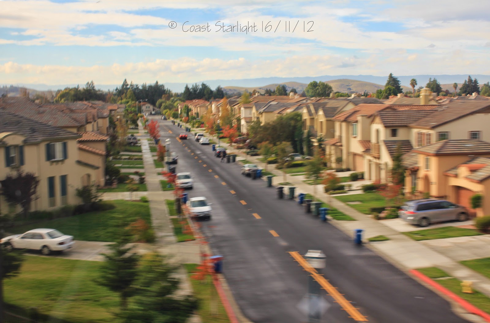
The Cal train California commuter train stops in San Jose.
San Jose the first state capital of the republic of California is now the capital of Silicon valley and notable for its affluence and high cost of living.
One of the major routes across the central California mountain ranges (from north to south) is US Highway 101. This major arterial is one of the last remaining and longest U.S. Routes.
Significant portions of this highway between the Los Angeles area and the San Francisco Bay Area follow El Camino Real. We raced the traffic on the highway south to LA from San Jose.
The Santa Clara Valley is sandwiched by the Santa Cruz Mountains and the Diablo Range (Devil Range).
It was somewhere here in Santa Clara Valley that John Steinbeck cultivated the vineyards of ‘The Grapes of Wrath’.
Running along the The Santa Cruz Mountain range is the San Andreas Fault - the boundary between the Pacific Plate and the North American Plate. We crossed the San Andreas Fault at Pajaro Gap near Watsonville.
Somewhere here near Castroville is a wildlife lake - the Elkhorn estuarine reserve.
Salinas valley has a perfect climate for farmin includin grape-growin for wine-makin. Somewhere near Salinas, bored, a lette slipped away...
We passed the southern section of the Diablo Range then followed Salinas river for many a mile. The Salinas River is a wildlife corridor and the principal source of water for the farms and vineyards of the Salinas Valley. The river flows past many small towns through the Valley before emptying into Monterey Bay.
After passing through King City at the south end of Salinas valley we come to San Ardo where a plague of grasshopper-like pumpjacks swarm the oil fields.
In San Miguel I asked for some san miguel. Instead they gave me a glass of wine from the vineyards of Paso Robles.
El Paso de Robles is a town nestled in the coastal mountain range.
The train was climbing up the mountains and I was getting giddy. The attendant offered me another glass of wine. I said ‘pass’, and he said ‘we’re there soon.’ I mulled that over a bit. The attendant looked sharp and he had a point I guess, but really I was not thinking of anything like Tirad Pass. So anyway the next minute we were crossing Cuesta Pass. This pass is a major topographical feature on the historic El Camino Real, traversing the Santa Lucia mountains and connecting the Salinas Valley to the north and the San Luis Obispo Creek Valley to the south. The train next negotiates two sweeping horseshoe curves where we can see the both the front and tail ends of the train.
Photo of the front end of the Coast Starlight train from within the train.
San Luis Obispo with its ocean misted farms was the first city to ban smoking in public places back in 1990. From here the sand dunes of the pacific, and the long white beaches and the spectacular views of the sunset of Pismo Beach, all come into view. Pismo is a beach town on California's central coast along the Pacific Coast. Here we split with Highway 101 as we went beachside. And so without changing trains I changed from the Mountain Range Starlight to the Coast Starlight. By my reckoning the route of the Coast Starlight train is only less than a quarter coastal. It doesn't really matter because at that time in the early Winter, night had already fallen.
So I did not really see much for the remainder of the trip. We did go past Vandenberg air force base and Santa Ynez mountains. And in the oil fields west of Santa Barbara, there are new housing developments sited on areas formerly occupied by pump-jacks, derricks, and oil storage tanks.
It was late in the Fall and the missin' lette is still missin'. With the sunlight fadin' and the free wind blowin', an' the season's cryin' no despair, I could see Ventura - Highway 101 agin. The days are shorte indeed, e'en in t sunshin' or t beach's an win'ries.
The first earth day was in Santa Barbara. The "American Riviera" city lies between the steeply rising Santa Ynez Mountains and the Pacific Ocean.
After some dinner (nachos pasta and wine) the agreeable climate and fertile soils of Oxnard greeted good evening. Oxnard is one of the wealthiest areas in America and part of the larger Greater Los Angeles area.
In the evening, we go inland again and climb to Simi Valley situated 30 miles from Downtown Los Angeles.
The Santa Susana Mountains
We tunnel through the Santa Susana pass and come out to the San Fernando Valley encircled by the Transverse Santa Monica mountains and the San Gabriel mountain Ranges. The Transverse Ranges are mountain ranges oriented east–to-west, or ‘’transverse’’ to the general north–south orientation of most of California's coastal mountains. The San Gabriel mountain range lies between the Los Angeles Basin and the Mojave Desert.
Nice Van Nuys flashed past in the night, and likewise Burbank the "Media Capital of the World", northwest of downtown Los Angeles. But the lights of LA county didn't look like diamonds in the sky...
And so I arrived at Union station in LA, one of the last of the great Union stations.
.jpg)
.jpg)
.jpg)
.jpg)
.jpg)
.jpg)
.jpg)
.jpg)
.jpg)
.jpg)


+(2560x1920).jpg)
+(1823x2560).jpg)
+(2560x1826).jpg)
.jpg)
.jpg)
.jpg)
.jpg)
.jpg)
.jpg)
+(2).jpg)
.jpg)
.jpg)
.jpg)
.jpg)
.jpg)
+(2281x2560).jpg)
.jpg)
.jpg)
.jpg)
.jpg)
.jpg)
.jpg)
+(2560x1828).jpg)
.jpg)
+(1280x843).jpg)
+(1280x948).jpg)
+(1280x827).jpg)
+(1280x852).jpg)
+(1280x820).jpg)


.JPG)
.JPG)
.JPG)
.JPG)


.JPG)
.JPG)


.JPG)