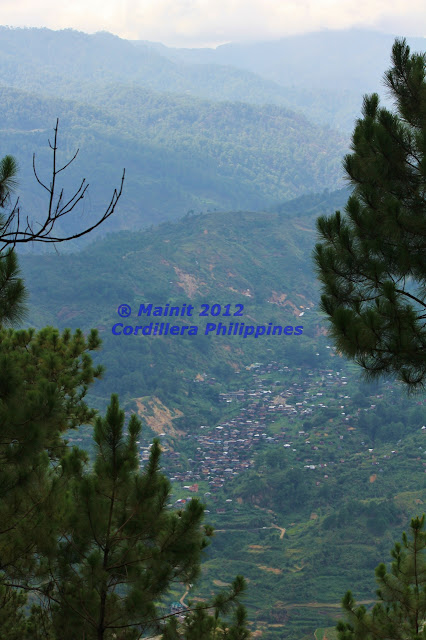
Photos from Mainit, Bontoc Municipality, Mountain Province, Cordillera region, in 2012.
The pristine blue of a mountain stream uncorrupted and unpolluted by human activity. A cupped handful of water from here is literally liquid gold. Nay it's more precious than gold, a thousand times more valuable than any bottled springwater from anywhere on earth.
Many of the hidden wonders of the Cordillera are seen from the mountains of Mainit. Above is the Livo-o lake, a magical sea of clouds in the foreground of Mt Kalawitan. This lake only appears at certain times. Many of the high mountains of the Cordillera are also best viewed from Mainit.
Do not sully our waters. Especially this blue ribbon, blue label liquid gold.
Follow the lead of the I-Fidelisan in Sagada, and shut down mining operations that pollute our watersheds, waterways and fields.
.jpg)
Lake Livo-o.
Mt Amuyao in Barlig - above and below.
Mt Amuyao is the 4th highest mountain in the Cordillera region.
Views toward the village of Guina-ang in the Patoc-Chakkang range (Maligcong is behind Mt Patoc at middle-left), Bontoc lies behind Mt Pokis in the middle. Mt Polis and Mt Kalawitan are in the distant range in the background.
A close-up view of the Mt Polis gap on the Mountain Province - Ifugao border. The dim shape of the Bontoc-Banaue road climbing towards the towers on the gap is just visible.
Inudey falls in Bauko. Mt Data is just off-picture to the left, but Mt Singakalsa (3rd highest in the Cordillera) in Atok is clear as day.
Mt Kalawitan in Sabangan is an accessible mountaineering destination. But the best views of it are from the inaccessible mountains in Mainit.
Another view towards Guina-ang, Mt Pokis, Polis gap and Kalawitan.
Yes Givanay, there is a mountain vista such as thissa.
The road to Guina-ang from Mainit, just below the Chakkang rice terraces.
Mainit with Chakkang fields in the foreground.
I'll have more of that blue label stuff please.
The western/southwestern range bordering Mainit from Abra. This is the headwaters of Pasil river (behind the mountain slopes at bottom right) which flows north (east of picture) to join the Chico river in Kalinga.
Philippine history 101 - Mainit history. Vantage point: Mt Mengmeng (Bandilaan).
Bandilaan is the name given by the people of Mainit to the mountaintop (Mengmeng) where Filipino revolutionaries planted the Filipino flag in defiance and resistance of American rule. That ridge line heading away from bottom left of picture, is the escape route of those pioneering Filipino trail runners, a ragtag band of freedom fighters led by one Emilio Aguinaldo, on their flight from the colonial american army during the Philippine-American war. Aguinaldo followed the trails overlooking the Pasil river and found temporary refuge in Lubuagan where he set up the seat of the Philippine revolutionary government.
Talkin' 'bout a revolution? Oh no. Don't even whisper it, or you better run...
Let's leave talk about revolutions, but when those politicians get to be revolting -
The secret to the beauty and stability of the many fields of green and gold in these mountains,
is stonewalling.
(I knew it Polichay. You stonewalling obstructionist you.)
We'll take that interjection as a comment,
but I do wonder where our forebears learned their stonewalling tactics from?
Anybody know?

+(853x1280).jpg)
.jpg)
+(853x1280).jpg)


+(2560x1844).jpg)


+(2560x1707).jpg)
.jpg)
.jpg)
.jpg)
.jpg)
.jpg)
.jpg)
.jpg)
.jpg)
.jpg)
.jpg)
.jpg)
.jpg)

.jpg)
.jpg)
.jpg)


Great pics of some towns of the Cordillera!
ReplyDeleteBeautiful!
ReplyDelete