There are precious few places on Earth that still contain many
plants and animals that have remained relatively unchanged from their ancestors from 55-180 million years ago. Gondwana Rainforests of Australia World Heritage Area
contains remnants of the great rainforests that once covered the continent. These
rainforests represent the major stages of the Earth's evolutionary history and the
ongoing geological processes. They contain the most important and significant
habitats where threatened species still survive.
One such UNESCO World Heritage Area is the Main Range National
Park in Queensland. To help celebrate the 25th Anniversary of the Queensland
side of the Gondwana Rainforests of Australia this year 2019, I visited the Main
Range for a couple of days of bushwalking through landscapes that took millions
of years in the making.

The Mistake mountain range sits on the north end of Main Range.
Main Range National Park is a landscape of rugged
mountain ranges and ancient peaks, dramatic escarpments with spectacular
lookouts, and slopes and valleys covered in thick forests. The park is inhabited
by unique wildlife including common and rare or threatened species of significant
flora and fauna. The walking trails traverse the lush subtropical rainforests,
open eucalypts and vibrant mountain heathlands. The views from the popular
lookouts are indeed spectacular and breath-taking, but it is another experience altogether having to navigate steep climbs, rocky outcrops, dense forests and rugged cliffs. just to
reach the secluded mountain nooks of the park.
Main Range is one of the largest national parks in South East
Queensland. It extends from the Mount Mistake range in the north to Wilsons
Peak in the New South Wales border on the south.

Queen Mary Falls is one of the notable waterfalls in the park.

Rocky outcrops are features of the mountainsides. Most of the Main
Range mountains are composed of trachyte and rhyolite or basalt rocks of
volcanic origin which have formed into sharp peaks or domes.

Holey rocks adorn the Mount Mitchell track.

Mount Mitchell is spectacular whether in full sunshine or
covered in mist-shadow. The high-altitude rainforests (cloud-forests) of the Main Range
receive their moisture from fog-drip.


Magnificent specimens of trees are aplenty on the Box Forest track.

The Main Range area is one of the best places on earth to see Araucaria such as Hoop Pines and ancient ferns.

Box trees (Lophostemon
confertus- bottom right) predominate on the Box Forest track.

Jumpin' Jack (not) on Mount Cordeaux track.

Mount Mitchell track

Palm Grove track

Rainforest track
Some of the birds-

Brown Cuckoo

Green Catbird

Albert’s Lyrebird

Logrunners, no not the avian kind.

Mount Mitchell from the Rainforest Circuit.

Mount Mitchell track


Mount Mitchell in cloud from Palm Grove track

Palm Grove track

Rainforest track

Box Forest track

Queen Mary
Falls exhibiting its trachyte cliff face typical of the Main Range escarpments.

The Ramparts is the main feature of the eastern escarpment. View from Morgans lookout

Mount
Cordeaux


Mount
Cordeaux track

Bare Rock
track


The Ramparts from Bare Rock.

Mount
Maroon and Mount Moon from Bare Rock

The west
peak and east peak of Mount Mitchell.

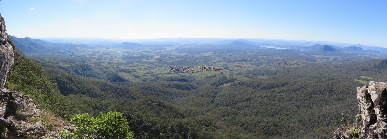
Lake
Moogerah flanked on the north (left) by Mount Greville and Mount Edwards, and on
the south (right) by Mount Moon and Mount Alford. The Cunningham Highway and Mount
Mathieson are at bottom.

Mount Mitchell trail.


The
Ramparts

Mount
Greville, Lake Moogerah and Morgans Lookout

Looking southeast
from Bare Rock towards Morgans Lookout and the peaks (Moon, Toowoonan and Maroon) in the direction of Rathdowney.

Looking north to the Mount
Mistake range from Bare Rock.
From Mount
Cordeaux overlooking the Fassifern Valley

Mount
Barney in the far left and around to Mount Mitchell at right.

Looking
the other way, from Mount Mitchell looking at Mount Cordeaux.
Mount Mistake is at mid-left and Mount Castle at the end of the range at right.

Mount Moon (at far left) to Mount Barney and the McPherson Range.


Lake Moogerah

The Ramparts

The northern end of Main Range as viewed from Cunningham’s Crest.

View from Carrs Lookout -
The southern end of Main Range is landmarked by Wilson’s Peak.
Mount Superbus is on the left.

South of Main Range is Mount Barney National Park.
No comments:
Post a Comment
please leave a comment.